|
| Our Field Ecology Center published more than
180 methodical materials for nature studies. Some of them are in English: |
|
|
|
Complex Comparative Description of Small Rivers and Streams
© Alexsander S. Bogolyubov,
Daria N. Zasko, Russia, 1999
© Michael J. Brody, USA,
2003
 This manual provides a simple scheme of
exploring simple hydrological as well as chemical and biological features of a water body.
A simple form of data description was developed in order to simplify the recording of
survey data and its standardization. This form includes all general data on the water
body, which can be collected without using special devices or equipment. This manual provides a simple scheme of
exploring simple hydrological as well as chemical and biological features of a water body.
A simple form of data description was developed in order to simplify the recording of
survey data and its standardization. This form includes all general data on the water
body, which can be collected without using special devices or equipment.
This field study has instructional video
featuring real students conducting the ecological field techniques in nature. Each video
illustrates the primary instructional outcomes and the major steps in accomplishing the
task including reporting the results.
Introduction
Conducting hydrological studies can be a very complex and difficult task. This manual
contains the simplest procedure for exploring a body of water, attempting a
description, and the preliminary evaluation of its environmental state. This procedure is
based on visual examination, requiring no special equipment, instruments or technical
devices.
This lesson is designed to be conducted by several groups of students (3-5 pupils),
each group studying its own body of water (a small river or a stream). After all the field
data has been collected, the groups compare their results. Another option is that one
group studies several water bodies and then compares the results.
The following items are required for the research: a measuring tape (from 5 to
50 meters long, a pole marked into 10 cm segments, thermometers, plastic bottles for water
samples, 10-20 liter plastic bag or bucket, a watch with a second hand and chemical test
kits or reagents.
Procedure
General information
The following procedure of exploring the description of a water reservoir can be
applied to any small water body: a river, stream, pond, lake or reservoir. Larger bodies
such as seas or oceans require other procedures for description.
In order to make recording easier when conducting an exploratory survey, an Exploratory
Description Form for a water body was developed (Table 1 at the end of this manual).
All research is based on filling the form out and analyzing the information.
Filling out the form starts immediately in the field. The data of additional research
as well as the results of field data handling will be recorded on the back of the form.
Names of those who conducted the survey should also be written on the back of the form.
The following information is to be included on the main (front) part of the form:
Date of observation - day, month, year.
Weather conditions - weather conditions of the day when the observation was carried
out should be described - air temperature in the shade, cloudiness (according to a
10-point scale, where 0 = completely bright sky, and 10 = totally overcast sky), wind
strength (no wind, gentle breeze, strong), absence/presence of precipitation, if
precipitation is present, then its type (rain/snow) and intensity (slight,
strong). During cold times of year, occurrence and depth of snow cover on the
shore as well as ice and snow on the water surface should be recorded.
Type and name of the water body (for example: Oak Creek, Missouri River, etc.)
Location of the studied area (observation site) - name of the administrative
district where the observation site is located and its distance from the nearest human
settlement or any other constant landmark (for example, 300 m up/down the
town/settlement N, dam, bridge, etc.)
Vicinity description (description of the surrounding environment) - that surrounds
the water body. If there is a settlement, then its type (city, town), type of
housing system (stone many-storied/low-storied buildings, wooden houses, summer houses,
sheds (barns), garages, etc.) should be recorded. If there is an industrial zone then its
features should be written down, if there is a forest - what kind (coniferous,
deciduous, coniferous-broad leafed), if there is an agricultural land then it should
be specified - fields, meadows, pastures etc.
Morphometrical features of the site - its width, average depth (in meters),
stream velocity (in meters per second), shore type (sloping, steep, beach, artificial
bank), slope of the bottom (slopping, abrupt, steep), if possible, slope in
degrees.
All these measurements are taken in the same part of the water body where the survey
...
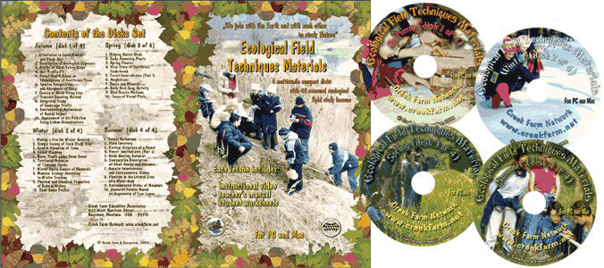
This was only the first page from the manual and its full version you can see in the
Ecological Field Studies Techniques Video 4CD Set:
It is possible to purchase the complete set of 40 seasonal Ecological Field
Studies Techniques Video (in mpg format) in an attractive 4 compact disk set.
These compact disks are compatible with Mac and PC computers.
The videos are suitable for individual student or whole class instruction. To purchase the complete 4CD set
write to ecosystema1994@yandex.ru in a free form.

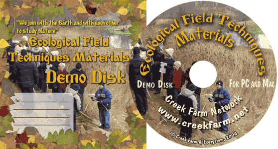
Ecological Field Studies Demo Disk:
We also have a free and interesting demonstration disk that explains our ecological field studies approach.
The demo disk has short excerpts from all the seasonal field study videos as well as sample text from all the teacher manuals.
The disk has an entertaining automatic walk through which describes the field study approach and explains how field studies meet education standards.
You can also download the Demo Disc from ecosystema.ru/eng/eftm/CD_Demo.iso.
This is a virtual hybrid (for PC and Mac computers) CD-ROM image (one 563 Mb file "CD_Demo.iso").
You can write this image to the CD and use it in your computer in ordinary way.
You also can use emulator software of virtual CD-ROM drive to play the disk directly from your hard disk.

|


