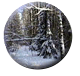
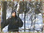
- Making a Fire for Winter Survival
- Simple Survey of Field Study Site
- Growth Dynamics of Trees
- Forest Mapping
- Green Plants under Snow Cover
- Territorial Behavior of Titmouse Flocks
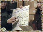
- Winter Route Census of Mammals
- Mammal Ecology According to Winter Tracking
- Physical and Chemical Properties of Natural Waters
- Snow Cover Profile
Ecological Field Studies Techniques Video 4CD Set:
It is possible to purchase the complete set of 40 seasonal Ecological Field
Studies Techniques Video (in mpg format) in an attractive 4 compact disk set.
These compact disks are compatible with Mac and PC computers.
The videos are suitable for individual student or whole class instruction. To purchase the complete 4CD set
write to ecosystema1994@yandex.ru in a free form.

 |
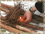
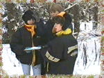
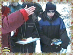
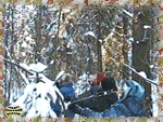
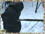
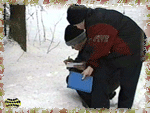
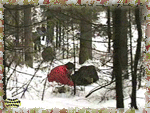
This activity is devoted to the skills of winter expeditionary research
camp life. Students learn the peculiarities of selecting a place for fire making,
techniques of fire kindling and the storing of firewood. |
This activity emphasizing practical skills is an interesting and fun way
to introduce students to nature in winter and helps develop a positive attitude for
subsequent field ecology lessons.
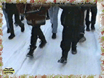
In the simplest terms, ecological field studies in winter require that the researchers
stay warm and have the ability to survive in extreme weather. Students can learn a great
deal from being challenged to take care of themselves and work together for survival in
adverse situations. |
 |
 |
Not only do they learn concepts related to trees and forest ecology,
skills related to working together and practical survival, but they also develop a sense
of appreciation for how field ecologists must work to study in winter's harsh conditions. |
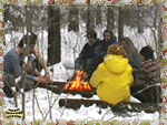
Training of students in making fires can be organized in the form of a
competition, who will make the fire faster and use less matches. Students find this
activity interesting and fun.
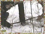
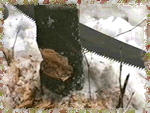
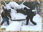
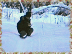
Harvesting of firewood is as important as fire making. It requires real work and specific
skills with a saw and an axe, as well as knowledge of rules how to fell standing trees. |
 |
 |
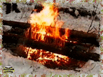
There are many types of fires, which have been designed for different
purposes - to provide light, to provide a heat, to cook, to organize an overnight stop on
an expedition. |
| The simplest fire can be used in a short-term day camp, i.e. it will
provide heat and enable cooking a meal. In order to organize an overnight stop field
researchers recommend building a fire which requires thick logs and skills to fell dead
trees. |
 |

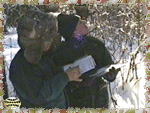
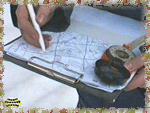
Lesson #2:Simple Survey of Field Study
Site
|
 |
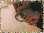
In this field study students learn to use a compass, to measure angles
and distances in the field and to make a simple map of the study area.
The practical part of the lesson requires students to measure azimuths of different
objects around. It is important that each student master the techniques of azimuth
measurement and can accomplish the task independently and in any situation. |
| The next stage is devoted to teaching students how to measure distances
in the field. The easiest method is to measure distances by counting steps. In order to
master this technique, each student should walk 100 meters, measured off at the site and
to count their steps. |
 |
 |
Then students learn how to conduct the eye survey of the area. Main
measurements during eye survey include determining azimuth or directions of major roads,
forest cuttings and paths as well as measuring distances between turns, crossroads and
other landmarks. |
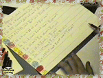
| Results of all measurements are either written down in a field diary or
marked on a draft of a future map of the area. The draft contains accurate values of
angles and distances as well as an approximate drawing of the plan of the area. |
 |
 |
The result of the lesson is a plan or map of the area or a map of the
covered route plotted according to a chosen scale. |
| The emphasis in this field study on accurate measurement and the
description of a specific study site is essential for ecological field studies. Science
process skills are integral to the success of field studies and must be learned in order
to conduct subsequent research. |
 |
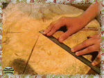 |
This activity will help students understand the structure of a tree and
help them recreate the history of tree development and growth. Students will learn how to
measure annual rings and graph tree's growth dynamics. |
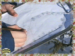
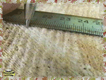
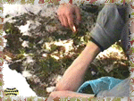
| The main focus of study is a cut cross section of the tree trunk. The
measurements of annual rings begins with drawing a thin line from the center of a disk to
the cortex. A sector of the trunk with the least number of anomalies should be chosen for
measurements. |
 |
 |
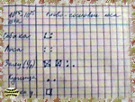
The width of the annual rings that are visible on a cross section of a
trunk, is the focus of measurements. Measurements of width of annual rings, i.e. annual
growth of a tree, are easily carried out by a team of two students: one measuring width of
rings, the other recording results in the table. |
| The results of measurements are recorded in the data table, where the
position of the annual ring border measured on a ruler corresponds to each year of the
tree's life. Annual growth values are estimated based on data indicating the position of
the annual ring borders. |
 |
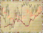 |
The results of measurements are presented in the form of a graph of tree
growth dynamics for its life history. Growth patterns can be related to various external
factors; climatic conditions, fires, forest management cuttings or changes within the
forest community. |
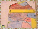
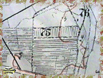
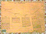
| In this field study students will learn how to make a map of forest
vegetation using geobotanical descriptions and eye survey. We recommend starting with
direct instruction on structure of forest plant associations and description methods. |
 |
 |
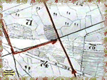
When selecting a site for geobotanical mapping we recommend having ready
a cartographic framework, where pupils will draw boundaries of different forest types and
record their descriptions. |
| Each team of students should have a map of the area and a compass,
students should measure their covered distance by counting steps, students should try to
move along a route agreed in advance and make descriptions of forest vegetation while
walking. |
 |
 |
The technique of geobotanical descriptions while making a map of the
forest is standard. First, structure of the top forest layer is described including
species compositions, crown density, formula of forest stand, average diameters of trunks,
height and age of trees. |
| In the laboratory, student teams combine their data into a single map of
vegetation of the studied forested area. Main forest types are marked on the map in
different colors on the basis of a contour drawn in the forest or a refined map and
completed forms of vegetation descriptions. |
 |
 |
In addition to vegetation, major landmarks are also plotted on the map
including forest cuttings, roads, power transmission lines, etc. A completed map should
have legend, title, scale and North-South direction. |
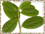
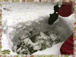
| This field study focuses on the study of evergreen or
"winter-green" plants. Students will analyze adaptation of plants in different
biotopes. The lesson begins with description of various plant adaptations to winter. |
 |
 |
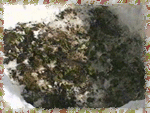
Student work focuses on the study of species composition and numbers of
green plants in different biotopes. We recommend choosing contrasting plant associations
for the study, for instance, a deciduous, birch, pine or fir forest and an open meadow. |
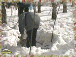
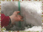
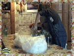
| The study begins with laying down a snow pit, that is the removal of the
snow cover at a typical, preferably flat, site in the middle of the plant association.
Size of the site should be not less than one square meter. We recommend one study site be
in a forest setting. |
 |
 |
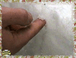
A contrasting biotope which can be used for comparison of the study
results is an open grassy community such as flood-plain meadow. Comparative studies will
demonstrate the nature of adaptation of winter-green plants in forests to conditions of a
short intense light period in spring. |
| The final report should present the main conclusion of the study:
winter-green plants found in forests are adapted to early spring development, therefore
they remain green all winter, ready for early spring growth before the forest leafs out
and light intensity diminishes. |
 |
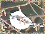 |
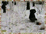
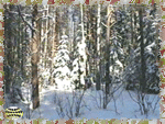
The goal of this field study is to determine the territory of a titmouse
flock in a winter forest. |
| The work begins when a group of students locates a flock of birds in the
forest. In order to make bird observations easier, we recommend choosing forested sites
which can be easily seen through, for example, deciduous or pine forest. |
 |
 |
The work starts with a search for a suitable flock. Students may walk
slowly along a trail or road in the forest. When students hear bird voices, they leave the
trail and start observations. |
| At the initial stage of observations the most important task is to
characterize a flock, that is, to count how many and what birds it consists of, what
direction and with what speed the birds fly. |
 |
 |
The next and the most difficult stage of observations is flock tracking.
The task of observers, who lead the way, is to follow the flock as long as possible
without losing the birds and paying attention to any obstacles. |
| The task of other members of the team is to follow the observers, to
record the main types of bird activities as well as to plot the route of the flock
movement on the map. The entire route of flock tracking should be plotted on the map. |
 |
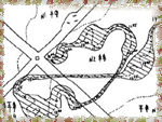 |
The ultimate goal of field observations is to determine feeding territory
of the flock, i.e. its habitat in winter. The main result of field observations is a map
of the flock movement route where timing marks and covered distances are plotted. |
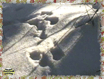
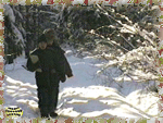
| While performing this field study students will discover the rich
diversity of mammals found in the forest and learn how to carry out a census according to
a standard procedure. |
 |
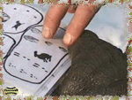 |
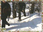
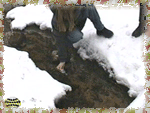
The activities begin with helping students learn identification of tracks
on the snow cover including demonstrating real and painted prints of animal paws, which
are abundant in the given area. |
| The procedure of winter route census of mammals begins with choosing a
straight-line or closed-loop route along trails or old forest roads. A census taker should
go along the chosen route a day before the study and drag a branch or a young tree over
the snow. |
 |
 |
The tree rubs out all old footprints and marks, in fact it makes a
"plowed strip" along the whole future census route. Erasing all old animal
tracks is necessary in order to determine the number of animals, which left their
footprints the previous day. |
| On the day of the census, i.e. exactly one day after all tracks have been
rubbed off, a record keeper goes along the same route and carries out the census. Each
track crossing the line of the census route is determined. |
 |
 |
A record card of the route census is made on the basis of the data. The
number of each mammal species tracks and all corresponding information including the place
of census, date and time and description of weather conditions should be recorded in the
record card. |
| Density of each identified animal species per unit of area is calculated
according to the formula provided in the manual. When presenting results of the census, it
is advised to show a map of the studied area with plotted study route. |
 |
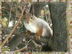 |
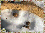
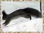
This field study focuses on "tracking" of mammals, the study of
tracks left by animals in the snow. Students should be familiar with the tracks of
abundant species of large and middle size mammals such as rabbit, squirrel or fox. |
| Activities begin with a lesson devoted to recognition and determination
of tracks of animals found in the study site. At the same time, students should be aware
of other traces of wildlife such as biting marks, regurgitates and droppings. |
 |
 |
When suitable footprints crossing a road or trail are found, researchers
mark the location on a map and begin to follow the tracks. We recommend following the
tracks against the movement of the animal so as not to catch up with and disturb it. |
| Another main part of this field study is plotting the route of animal
movements on the map. Success of the work depends entirely on students' ability to work
with a map and compass, to measure distances in the field and general skills of
orientation in the study area. |
 |
 |
Beside tracking the route of an animal, students also record other forms
of activity, such as laying down, contacts with other animals and feeding places. It is
necessary to write down the main kinds of food as well. |
| Regardless of the animal species, all traces of its vital functions
should be marked on the map with the help of conventions or numbers; at the same time
students provide simple descriptions of peculiarities of animal behavior in their field
diaries. |
 |
 |
On the whole, studies based on tracking of mammals can be carried out
during the entire winter, we recommend conducting this work on days when there is no
strong winds or snowfall, it is better to carry out the investigation a day or two after a
snowfall. |
| Presentation of the results is limited to plotting of the animal movement
route on the map, where different forms of animal behavior are also marked, including
lies, feeding places, territorial marks and other similar traces of vital functions along
with their descriptions. |
 |
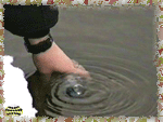 |
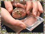
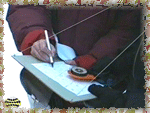
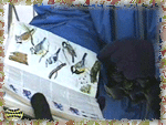
The goal of the field study is to compare properties of water from
different sources. Students learn how to sample, determine physical properties and simple
chemical analyses. |
| Sampling should be carried out from different natural waterbodies
(rivers, streams, lakes and ponds, water reservoirs) and other available water sources,
for instance, wells, springs, dead-water, water facilities in order to compare properties
of water. |
 |
 |
Sampling of snow is a little more difficult, as it can be of different
types: layered or cumulative. When the study is carried out for educational purposes, it
is advised to take samples of snow from different sites, which are contrasting according
to level of pollution. |
| A number of parameters are evaluated when studying physical properties of
water. First of all, clarity should be assessed. Color of the water is also evaluated.
Chemical analyses of water depends on available equipment, reagents or test kits. |
 |
 |
Comparison of all studied water-bodies and water sources should be
carried out when presenting results. Students should also try to provide explanations of
differences in properties of water under influence of different natural and anthropogenic
factors. |
| In this field study students will learn how to conduct a snow measuring
survey, how to organize field studies in a landscape profile, techniques of snow surveying
and presentation of the results. |
 |
 |
It is recommended to conduct the snow-measuring survey along the profile
line where the Autumn slope survey was conducted. It will allow students to compare
structure of snow cover in the profile to specific aspects of topographic relief. |
| First, it is necessary to create a snow pit, that is, to dig out a hole
in the snow with a vertical front wall. The front wall should be carefully smoothed out
with a shovel immediately before the description in order to eliminate damage to the front
wall. |
 |
 |
Then the snow cover is described layer by a layer. Mechanical
characteristics are described, including structure and density of the snow in each layer.
Thickness and mechanical properties are described in the form of a table or draft scheme
in the field diary. |
| Presentation of results of the snow-measuring survey is usually the
drawing of the profile scheme, where stratigraphic columns are plotted. Snow structure and
density are usually shown with the help of symbols and colors. |
 |
See the manual "Study of Snow Cover
Profile"
Top
Ecological Field Studies Techniques Video 4CD Set:
It is possible to purchase the complete set of 40 seasonal Ecological Field
Studies Techniques Video (in mpg format) in an attractive 4 compact disk set.
These compact disks are compatible with Mac and PC computers.
The videos are suitable for individual student or whole class instruction. To purchase the complete 4CD set
write to ecosystema1994@yandex.ru in a free form.
Ecological Field Studies Demo Disk:
We also have a free and interesting demonstration disk that explains our ecological field studies approach.
The demo disk has short excerpts from all the seasonal field study videos as well as sample text from all the teacher manuals.
The disk has an entertaining automatic walk through which describes the field study approach and explains how field studies meet education standards.
You can also download the Demo Disc from ecosystema.ru/eng/eftm/CD_Demo.iso.
This is a virtual hybrid (for PC and Mac computers) CD-ROM image (one 563 Mb file "CD_Demo.iso").
You can write this image to the CD and use it in your computer in ordinary way.
You also can use emulator software of virtual CD-ROM drive to play the disk directly from your hard disk.

|