- School Herbarium
- Flora Inventory
- Vertical Structure of a Forest
- Forest Invertebrates (Part 2)
- Birds Nesting Behavior
- Comparative Description of Small Rivers and Streams
- Aquatic Invertebrates and Environmental Status
- Plankton in the Littoral Zone of a Water-body
- Environmental Status of Meadows
- Status of Forests Based on Asymmetry of Tree Leaves
Ecological Field Studies Techniques Video 4CD Set:
It is possible to purchase the complete set of 40 seasonal Ecological Field
Studies Techniques Video (in mpg format) in an attractive 4 compact disk set.
These compact disks are compatible with Mac and PC computers.
The videos are suitable for individual student or whole class instruction. To purchase the complete 4CD set
write to ecosystema1994@yandex.ru in a free form.

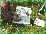 |
This field technique is the introduction to the summer ecological field
studies sequence and is devoted to skills, which are necessary for subsequent botanical
lessons. |
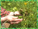
| Guidelines for plant collection include not collecting rare and beautiful
plants. Students should collect samples of typical plants, medium size, not the most
beautiful and not wilted. Plants should be dug out as a whole including roots and stems. |
 |
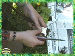 |
Plant specimens are put into newspapers and then into a herbarium folder.
Each leaf should be spread out, and some placed with their underside up. Flowers are
arranged the same way. |
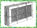
| When returning to school, plants from the folder are placed into
herbarium netting. All plants are examined and, if necessary, repositioned. |
 |
 |
In order to insure that flowers do not change their color during drying,
they should be salted or interlaid with salted dry paper. The same should be done with
large flowers, which have been flattened and spread out by hand. |
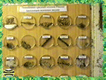
| A nice visual collection of mosses and lichens can be made with the help
of Petri dishes with covers. Each Petri dish is fixed on a board with a pair of nails with
wide heads. Petri dishes can be removed from the board for closer examination. |
 |
 |
In the course of this activity, students may also study species
diversity, habitat preferences, variations within species and other aspects of the plants
life cycles and ecology. In the process students also learn techniques for the
preservation of museum quality plant specimens. |

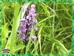
| In this field study students compile a complete list of flora species
growing in a given area. The main objective of this activity is compilation of the most
complete list of plant species possible. |
 |
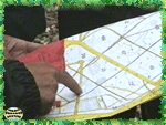 |
When planning the study try to visit as many different plant communities
in the area as possible: from forest to meadows, from floodlands to watersheds, from wet
to dry, from young to old, etc. |
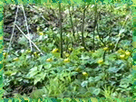
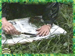
| It is best to conduct the floristic study in the form of standard
geobotanical descriptions at field sites; tree layer is described first, then the shrubby
layer and finally grass and moss-lichen layers are described. |
 |
 |
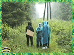
The botanical studies consists in identification of the greatest number
of species at the site. The students' role is to find as many different species as
possible. It is also convenient to combine this activity with construction of a school
herbarium. |
| When performing this work, it is necessary to take into account
seasonality of the flora. Students must understand that one survey of all available
biotopes will never result in a complete list of species. |
 |
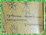 |
Field studies in search of new species should be carried out several
times a season, starting in early spring, in June and at the end of summer in order to
compile a complete flora inventory of a specific area. |
| The lab aspect of this study includes the identification of plants which
have been collected in the course of the class field excursion. This activity results in a
list of flora species divided according to plant communities. |
 |

 |
This field study helps students learn practical skills of summer
vegetation description using the example of a forest multilayered community. |
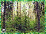
| When selecting a study site, it is best to choose a forest, which is
visually subdivided into a small number of layers, for example, a layer of prime forest
stand, layer of young growth along with an understory, and a herbaceous-shrub layer. |
 |
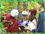 |
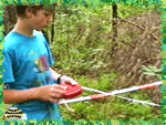
The first step is the delineation of the study site. This stage of the
work includes general description of the site location: its geographical position,
position of the site in relief, as well as specific features of the surrounding territory. |
| All data is to be recorded by students in a standard form of plant
association description, which has been developed for convenience of the collection and
recording of the information during the study. |
 |
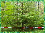 |
Measurements are carried out for all trees typical for the top layer or
canopy of the forest. Young trees of the primary canopy of the forest are described with
special attention paid to young seedlings promoting the process of reforestation. |
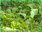
| The understory, species that will not become part of the top forest
canopy, are also described. Finally students record data on the herbaceous-shrub layer and
when possible the main plant species structure, and projective cover are estimated. |
 |
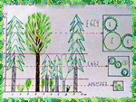 |
Following the field excursion, a diagram of layered (vertical) structure
of the forest should be composed for the observed plant associations. Students construct
the diagram in the form of a vertical forest section with corresponding descriptions. |

| The second part of forest invertebrate field studies (see spring lesson 5
for part 1) focuses on procedures for studying invertebrates found during the summer
season in the period of leaf growth and tree crown development. |
 |
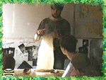 |
Field studies begin with an understanding of the ecological groups of
invertebrates and specific procedures for their study. There are specific methods of
collection and census for each ecological group of invertebrates, as well as specific
instruments for their collection. |
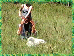
| The main strategy for invertebrate collection in the grass layer is
so-called mowing, this is efficient for non-flying insects, sitting on flowers and in the
top grass canopy. |
 |
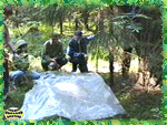 |
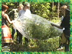
Collection of invertebrates found in crowns of large trees is a different
strategy. Typically the shaking down method is used. White cloth like a large sheet or
twofold polyethylene film for gardening is laid under the study tree. |
| It is more accurate to estimate density of forest invertebrates by using
a plastic film tube or big plastic garbage bag, into which a whole branch of the tree is
placed. The branch is then shaken down inside the bag. This procedure catches almost 100%
of the organisms. |
 |
 |
Field study techniques for diurnal flying invertebrates - mainly
butterflies - recommend visual census of butterflies along routes of constant width and to
identify species without catching individuals. |
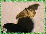
| Catching nocturnal insects is quite another matter. However, we also
recommend not collecting beautiful butterflies. Nevertheless, catching in the light on a
dark night is interesting. |
 |
 |
Identification of invertebrates is a laborious and technical activity. It
is recommended for student researchers to estimate species diversity, that is, the number
of invertebrate species under different conditions. |

| This field study helps students organize stationary ornithological
studies and become familiar with the habits of wild birds. |
 |
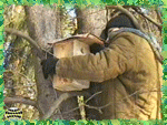 |
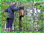
It is easier and more convenient to organize a study of birds' nesting
biology with the help of hanging artificial nesting boxes, that were made in spring.
Nesting Boxes should be hung no later than March so that birds will be able to occupy them
in the beginning of breeding season. |
| If nesting boxes are hung beforehand, then research should begin by
checking the boxes and mapping the locations of those that are occupied by birds. For
recording purposes it is ad-vised to use a geobotanical map marked with types of
vegetation, made in winter. |
 |
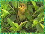 |
It is also important to pay attention to any signs indicating natural
nesting places of birds within the area under study such as the occupation of tree hollows
at the same time as mapping artificial nesting-places. |
| Observation of birds' nesting behavior is another research task; however,
it is convenient to combine this work with the previous one. The best time for
observations is the period of nestling rearing. |
 |
 |
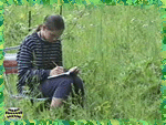
The observer should take up position not far from a nest. With a clear
view of the nest and the birds' main routes of approach to the nest. All of the bird
behaviors are recorded in a field notebook. |
| Student results consist of making a map of the area with the locations of
bird nests and their description as well as a recording bird behaviors at each location. |
 |

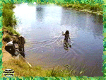 |
This field study describes a procedure for description and preliminary
evaluation of a water body to determine its environmental state. This pilot survey
requires no complex equipment, instruments or technical devices. |
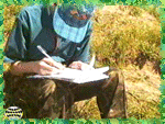
| All research is based on filling out the "Exploring Water Bodies
Description Form", which is specially designed to make recording and further research
data handling easier. The form begins with general information about the study site. |
 |
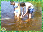 |
Next students begin the description of morphological features of the
water-body. The watercourse width and depth and stream velocity is measured. Later,
estimations of water output and stream flow volume are calculated based on these
measurements. |
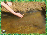
| Next students describe riverside aquatic vegetation and high water
plants. In the middle of the Description Form students record: shore soils and stream
bottom structure, features of the growth on underwater objects, pollution description and
associated water organisms. |
 |
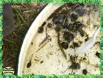 |
The next phase of the study focuses invertebrates living in the river or
stream. Samples are collected according to the standard sampling method with a scraper. It
is better to list as many different organisms associated with the reservoir as possible. |
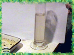
| Water samples are also collected in the field for further laboratory
tests. First of all, clarity, smell and color of the water should be assessed. The type
and number of chemical analyses may depend on tests and reagents available at school. |
 |
 |
Results of the work are presented in the form of project reports,
pictures and watercourse profiles. A possible form of a project report of the results is a
comparative table that combines water characteristics data with other features of the
studied reservoirs. |

| The focus of this lesson is the study of benthic macroinvertebrates in a
small river or stream and to determine its water quality based on the species composition
and prescence of various collected organisms. |
 |
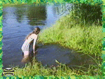 |
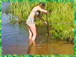
The study of benthic macroinvertebrates is best conducted on a small
river with slow current. In order to form a comprehensive view of animals inhabiting the
river, samples should be taken at several different sites. |
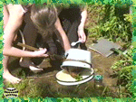
| All collected organisms are categorized and placed into jars for later
identification. The procedure is repeated several times. The more diversity and abundance
of species found, the more accurate and complete the study. The presence of all species
living in the area is most important. |
 |
 |
After sorting specimens in the lab, the collected animals are identified
using field guides and taxonomic keys, if necessary students can use magnifying glasses or
binocular microscopes to observe characteristics of the organisms. |
| According to the composition of water invertebrates in your sample,
environmental status of the river can be assessed. It is not necessary to determine exact
biological species, it is more important to find indicative taxons. Their list is given in
the manual. |
 |
 |
In the preparation of the final report it is desirable to have students
reflect on the entire range of collected invertebrates and to identify indicative ones
among them, i.e. those, which determine the level of water quality in the river or stream. |

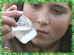
| In this field study students study zooplankton living in various water
bodies and determine their population density. Field work involves catching zooplankton
with the help of a fine-meshed, cloth plankton net. |
 |
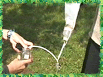 |
At the field site plankton is collected by pouring large volumes of water
through the plankton net. Selection of the site for sampling is determined by the presence
of large waterbodies in the locale of the school. |
| The field site can be a river with quiet current, overgrown with high
aquatic vegetation, with still areas and access to the riverbank. It can also be a stream.
It is important that there are some quiet sections in the streambed, where water is warmed
and there is no current. |
 |
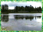 |
The best sites for plankton collection are nonmoving waterbodies: lakes,
ponds, pits filled with water and even temporary water bodies. |
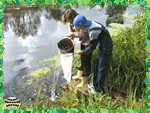
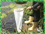
| Plankton is collected by pouring water with the help of a bucket through
the plankton net. Sampling should result in a small sample volume with concentrated
plankton from a known volume of water. |
 |
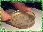 |
Quantities of collected plankton are calculated in the laboratory. A
specific accurately measured volume of water is examined under a binocular microscope at
high magnification, all organisms are counted within the sample. |
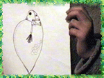
| Reporting results of zooplankton studies is quite simple, it is a
comparative analysis of species composition and numbers of zooplankton in different
waterbodies or in different parts of one large waterbody. |
 |

 |
This field study uses a bioindication method which allows an assessment
of a number of environmental properties of meadow plant associations according to the
presence and numbers of herbaceous plants.
Field study begins with selection of the site for the study. When conducting research it
is advised to collect material at different types of meadows, for instance, located on
floodplain, on a terrace, on terrace slopes, at the watershed and so on. |
| The next step is botanical description of the site itself. It should
begin with listing of all the plant species found within the site. The next stage of the
work is estimation of protective cover, meaning the percentage of the total area covered
with leaves of the given plant. |
 |
 |
The next and most labor intensive stage of the work is the description of
ecological characteristics of the plants. A standard form is used for this purpose, where
all identified plant species are listed with an indication of their protective cover. |
| A description of environmental conditions corresponding with each plant
is provided for each species depending on its protective cover. |
 |
 |
As a result of the analysis of the data in this study, levels of
moisture, soil resources, digression and other ecological factors corresponding to each
plant species found at the site are reported.
The data serves as the basis for assessment of environmental conditions of the studied
grass community. On the basis of these qualitative characteristics it is possible to
classify the studied meadow without labor-intense physical measurements and chemical
analyses. |

This field study addresses development stability as an indicator of
environmental state, the collection of field material as well as how to take measurements,
make calculations and interpret of results.
Different species of birch serve as the bioindication species. The objective of the field
study is measurement of the asymmetry of birch leaves, specifically, differences between
the left and right sides of a leaf. |
 |
 |
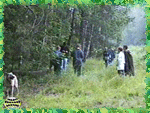
Field work begins with collection of leaf measurements in the laboratory.
We recommend collecting leaves from 10 different trees within one site or study area, so
that the total number of leaves collected at the same place is not less than 100. |
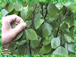
| In order to perform the best study it is necessary to collect leaves in
places which differ from each other in the level of disturbance or pollution, or to
conduct collection uniformly, when studying a large area and making a map of environmental
state of the area. |
 |
 |
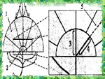
Processing the material is the most labor intensive part of the work. It
includes five measurements of left and right sides of each leaf separately and calculation
of their difference, resulting in a value of leaf asymmetry. |
| When measurements are completed, a value of asymmetric property is
calculated in three stages. First, relative difference between the left and right side of
the same leaf are calculated for each of the five measurements. Then an average value of
all the parameters of the same leaf is estimated. Next, an average value for all the
leaves of the sample is calculated. |
 |
 |
The result of the work is an index of asymmetric property for the given
site, a relative value which can be higher or lower than a norm calculated by authors of
the given procedure. The higher the asymmetric property, the worse is the environmental
situation. |
See the manual "Assessment of
Environmental State of the Forest Based on Leaves’ Asymmetry"
Top
Ecological Field Studies Techniques Video 4CD Set:
It is possible to purchase the complete set of 40 seasonal Ecological Field
Studies Techniques Video (in mpg format) in an attractive 4 compact disk set.
These compact disks are compatible with Mac and PC computers.
The videos are suitable for individual student or whole class instruction. To purchase the complete 4CD set
write to ecosystema1994@yandex.ru in a free form.

Ecological Field Studies Demo Disk:
We also have a free and interesting demonstration disk that explains our ecological field studies approach.
The demo disk has short excerpts from all the seasonal field study videos as well as sample text from all the teacher manuals.
The disk has an entertaining automatic walk through which describes the field study approach and explains how field studies meet education standards.
You can also download the Demo Disc from ecosystema.ru/eng/eftm/CD_Demo.iso.
This is a virtual hybrid (for PC and Mac computers) CD-ROM image (one 563 Mb file "CD_Demo.iso").
You can write this image to the CD and use it in your computer in ordinary way.
You also can use emulator software of virtual CD-ROM drive to play the disk directly from your hard disk.

|


