|
| Our Field Ecology Center published more than
180 methodical materials for nature studies. Some of them are in English: |
|
|
|
Complex Environmental Assessment of Human Impact on an Area
© Alexsander S. Bogolyubov,
Russia, 2000
© Michael J. Brody, USA,
2003
 This manual contains a procedure
for human impact study, which allows us to quantitatively evaluate the degree of
disturbance and the influence of human activities on the main landscape components:
relief, vegetation and soils. This study is based on the route counting of local objects
of human impact. The procedure is applicable for forested zones. This manual contains a procedure
for human impact study, which allows us to quantitatively evaluate the degree of
disturbance and the influence of human activities on the main landscape components:
relief, vegetation and soils. This study is based on the route counting of local objects
of human impact. The procedure is applicable for forested zones.
This field study has instructional video
featuring real students conducting the ecological field techniques in nature. Each video
illustrates the primary instructional outcomes and the major steps in accomplishing the
task including reporting the results.
Introduction
When conducting complex environmental expeditions, practical work and environmental
camps, young environmentalists and their leaders often face a task of the quantitative
estimate of total human impact on the surrounding environment. This manual provides a
simple procedure for conducting a complex route count of objects of human impact on the
area.
This lesson and the study procedure itself are developed primarily for research in the
forested zone Ц in the vicinities of a city, in a Forest Park or in a large city park.
This procedure is not applicable for small-forested areas less than ? square kilometer. In
this case it should be replaced by mapping the objects of human impact.
This study can be carried out by a group of students who do not have skills or
experience in complicated field research work. This work does not require special
knowledge of the names of animals or plants species (except some main tree and shrub
species). Only the well-coordinated work of the whole group is needed en route.
Methods (Procedure) of route counting
General information (Basic principles)
Route counting of objects of human impact (HI) is aimed at discovering the local forms
of human impact on the environment, which can be revealed and described based on
cartographic documents. This applies, firstly, to anthropogeneous damages of microrelief,
soil, vegetation and wildlife. While counting of objects of human impact, the main types
of plant associations are also registered as a foundation of the studied landscape.
Route counting allows us to obtain quantitative data on the anthropogeneous load
on the local environment, which can be compared with analogue data collected in other
areas and in other regions.
In order to compose valuable characteristics of HI on the selected area it is advised
to locate a counting route, which crosses typical habitats within the
boundaries of the selected area.
Counting is based on the method of the Уrandom" route, which is a
straight-lined route (without using roads) chosen with the help of a compass. The route
can be straight-lined and closed-looped (rectangular or triangle, but not circular)
returning to the starting point.
One should bear in mind when calculating the total length of the route, that longer the
route is, more precise (valid) the data is. The total length of the route should not be
less than two to four kilometers.
List of objects for route count of human impact objects and environmental conditions
In order to make counting easier, all objects of human impact are divided into three
groups: 1) "measurableФ objects: they have different sizes and their length can be
measured. 2) "Un-measurableФ objects: these objects usually have a Уstandard
size,Ф and 3) УspotФ or УpointФ objects: they are equally distributed in the
area as a rule.
УMeasurableФ objects are the following:
Anthropogeneous forms of microrelief: irrigation ditches, pits, rain rills and gullies
that are artificial in origin, embankments, bars, bumps, terraces on slopes etc.;
Soil and herbaceous vegetation damages caused by humans - vast areas damaged by heavy
vehicles, highways and country roads, paths, pits, grooves, garbage dumps, cattle tracks,
large soil trampling areas
Artificial water bodies and waterways - ponds, swamped areas, soil-reclamation and
other canals, drainage systems and so on;
forest anthropogenic damage - forest openings (various causes: forest management
cuttings, cuttings for electric power and communication lines, forest roads and
pipelines), felling grounds and burned-out forest areas.
Besides the description of human impact, the main types of plant communities
(associations) along the route should be also described. In the Moscow region, for
example, the following communities can be seen: spruce, pine, small-leaved, mixed...
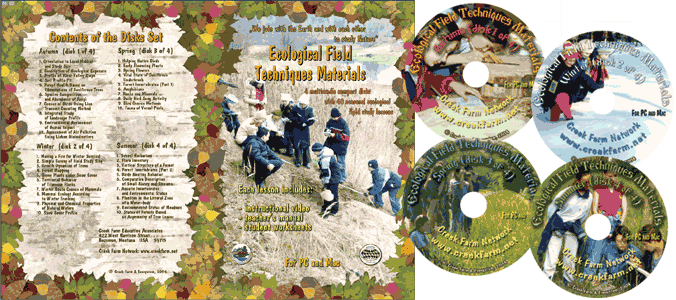
This was only the first page from the manual and its full version you can see in the
Ecological Field Studies Techniques Video 4CD Set:
It is possible to purchase the complete set of 40 seasonal Ecological Field
Studies Techniques Video (in mpg format) in an attractive 4 compact disk set.
These compact disks are compatible with Mac and PC computers.
The videos are suitable for individual student or whole class instruction. To purchase the complete 4CD set
write to ecosystema1994@yandex.ru in a free form.

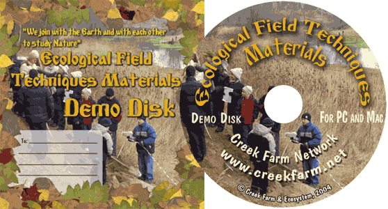
Ecological Field Studies Demo Disk:
We also have a free and interesting demonstration disk that explains our ecological field studies approach.
The demo disk has short excerpts from all the seasonal field study videos as well as sample text from all the teacher manuals.
The disk has an entertaining automatic walk through which describes the field study approach and explains how field studies meet education standards.
You can also download the Demo Disc from ecosystema.ru/eng/eftm/CD_Demo.iso.
This is a virtual hybrid (for PC and Mac computers) CD-ROM image (one 563 Mb file "CD_Demo.iso").
You can write this image to the CD and use it in your computer in ordinary way.
You also can use emulator software of virtual CD-ROM drive to play the disk directly from your hard disk.

|


